Geography is the study of places and the relationships between people and their environments. Geographers explore both the physical properties of Earth's surface and the human societies spread across it. Historical geography is the study of the geographies of the past and how the past is represented in geographies of the present. This website explores Frisia Ulterior, benorth the Old Rhine, and Frisia Citerior beneath the Old Rhine.

0. Castra Vetera - Traiectum - Utrecht - Castellum Veteris Traject
or the Castle Utrecht also Vidrus now Vecht into Zandvoort

1. Wedrou - Zandvoort - Estuary of the Vidrus coming
from Castra Vetera now the the city of Utrecht
along Haarlemmermeer to Haarlem

2a. Ascal - Angstel River - from Breukelen (Breuklijn) into the Amstel
at Amsterdam on the Vidrou or Vecht track out of Castra Vetera

2b. Ascalingion - Kamperhoofd and Kamperbrug - The Roman camp in
Amsterdam at The Nabalia (Oude Waal) and Ascal (Angstel, Amstel) Rivers
at the Amstel Ingang or Ingewoonden

3. Navalia - Nautic Velsen - The Naval Camp
archeology Site 1 in Velsen and Site 2 in Castricum

4. Insula Flevo - Kampereiland - The Roman location opposite
Kampen originating the Issel River or Flevum

5. Mararmanis Litus - Camperduin - Sea Marines or Coast Guard
at the seashore limes southern the Nabalia Estuary (also see 2 and 3)

6. Mediolanum - Middenlaan (Middlelane) - Hindelopen (Inlopen, Hinnlaufen, Eindelopen) (Inwalking) - Kreupel Wagenpad (Cripple Wagonpath) - A very long Lane from Medemblik into the former Westfrisian Middle Sea (IJsselmeer) onto Stavoren, Hindeloopen (Endwalking) and Lopens (Walking) - Medemelec ende Chinneloes

7. Tecelia - Texel - The Texel Naval camp at the Mokweg
 8. Fleum - Vliestroom - Vliestroom Estuary (also see 4 and 6)
 9. Su-at-ut-anda - See Abt out Anda - The former island Atlantis in between Sexbierum


(the Saxo Biro heim) and Vlieland. The Abt (a noble) is a Seabank with the volcano
chamber Griend (cry) under the island Abtland (ref. see my Ath oer Alinda Article)
Extra illustrations:
 |
Ptolemaeus Square-Meridian Corrections in Alting work by Heinsius
|
 |
| Frisia by D.I. Hopperus |
 |
| Batavia and Frisia by A. Buchelius |
 |
| The Netherlands before the Roman time |
 |
| The Netherlands in the Roman time |
 |
| The former Middle Sea in Friesland |
 |
| The Netherlands in the Roman time |
 |
| Frisiae Veteris in Atlas Schotanus |

| The Netherlands in the Roman time |
 |
| Scaldia in Flandria |
 |
| Germania Infererior during the Roman expansion |
 |
| The Lower Countries in the Roman era |
 |
| The Lower Countries in 724 A.D. |
 |
| Frisia in the Northwest of Europe around 1000 A.D. |
 |
| Enkhuizen-Stavoren canal by Nicolaes van Geelkercken |
 |
| Frisia in the antiquity by deep satellite photo |
 |
| The IJssel Lake in depth chart |
 |
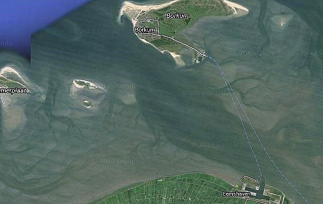
| The Wadden Sea Vliestroom Estuary |